
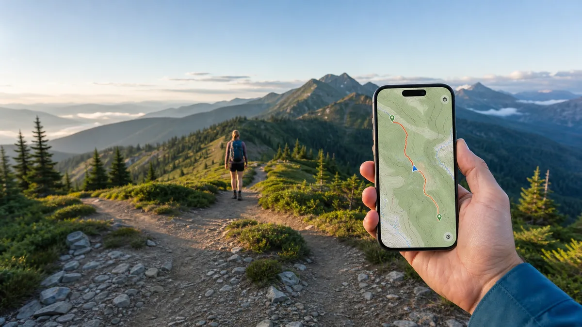
Pick by job, not by brand. If you need ideas, choose a trail-discovery app with searchable routes, difficulty filters, photos, and recent condition reports. If you already know the objective, choose a map-first tool for planning, topographic layers, GPX support, and offline orientation beyond mobile coverage. Some apps bridge both approaches. FarOut serves a narrower long-distance need.
This guide compares eight leading apps for walkers, hikers, and backpackers worldwide. Rather than naming one overall winner, it matches each app to the hiker it suits best. That range runs from casual walkers seeking nearby trail ideas to thru-hikers needing offline waypoint data. For every app, note what is free, what requires payment, and what must be downloaded before signal drops. Google Play ratings and install figures give market context. Themes from analyzed written reviews add bounded evidence of real use, not a final verdict.
Trail-discovery apps vs map-first navigation tools
Trail-discovery apps, including AllTrails, Wikiloc, and Hiking Project, answer “where should I hike?” They prioritize searchable route catalogs, photos, difficulty ratings, and community reports. Map-first tools such as Gaia GPS and OsmAnd answer a different question: “how do I plan and follow this route?” They offer detailed topographic layers, GPX support, and configurable offline navigation, but they expect more setup. GPX is a standard file format for GPS routes and tracks.
Komoot and Outdooractive sit between those groups, pairing strong route planners with community or officially approved route libraries. FarOut is its own category. It is a guide-based companion for established long-distance trails, not a general trail finder. No single app wins every job, so the picks below are segmented by hiker type.
The best hiking apps at a glance
| App | Best for | Offline maps (free vs paid, download required) | Pricing model (checked examples + local-pricing note) | Coverage notes | Platforms | Google Play rating |
|---|---|---|---|---|---|---|
| AllTrails: Hike, Bike & Run | Trail discovery | Paid only (Plus or Peak); must download before losing service | Free tier with ads; AllTrails Plus US$35.99/year with 7-day trial (checked USD example); Peak priced above Plus | Large global community catalog, strongest in well-mapped regions; trail data is community-sourced | Android, iOS, Wear OS, web | 4.6 |
| Gaia GPS: Offline Trail Maps | Backcountry navigation and detailed maps | Premium only; pre-trip downloads and Outside account required | Free tier has no offline maps; Premium and Outside+ tiers; Google Play IAP range US$3.99–$199.99; no verified official price, check local plan pricing | Hundreds of map layers; some (US public lands, USGS) are region-specific, not worldwide | Android, iOS, web planner | 3.4 |
| komoot - hike, bike & run | Route planning | First region free; further regions via one-time purchases; download required; no offline rerouting | Single Region US$3.99, Region Bundle US$8.99, World Pack US$29.99 one-time (checked USD examples); optional Komoot Premium subscription is separate | Global product with particularly strong recognition in Europe; regional map products vary | Android, iOS, Wear OS, web planner, Garmin/Wahoo sync | 4.2 |
| Outdooractive. Hike and Ride | Official topo maps and vetted routes (UK/Europe strength) | Pro feature per official plans page; download required | Free tier; Pro EUR 29.99/year, Pro+ EUR 59.99/year (indicative website prices, 7-day trial); confirm checkout or app-store pricing | Official topo partners (OS, Harvey, IGN, Swisstopo and others) in around 25 countries, strongest in Europe | Android, iOS, Wear OS, web planner | 4.4 |
| Wikiloc - Trails of the World | Community routes worldwide | Free offline maps; navigating your own or Wikiloc ORG routes is free; most community routes need Premium; download required | Premium with 14-day trial; Google Play IAP range US$0.99–$19.99; no stable global price published, check in-app local pricing | Global community-recorded routes, densest in well-mapped regions such as Europe; route quality varies | Android, iOS, Wear OS, Apple Watch, Garmin/Suunto/COROS, web | 4.6 |
| OsmAnd — Maps & GPS Offline | Offline-first, customizable navigation | Maps, search, routing, and GPX work offline after download; free tier caps downloads | Free tier with limited downloads; Maps+ (OsmAnd+) and Pro tiers; Google Play IAP range US$1.63–$69.99 | Worldwide OpenStreetMap-based data; trail detail depends on local map contributions | Android, iOS | 4.5 |
| Hiking Project | Best free option | Free downloads of trail content; GPS position works offline on downloaded trails (not every background layer) | Completely free, no ads, no in-app purchases | US-strong but regionally uneven; check your destination before relying on it | Android, iOS (syncs with HikingProject.com) | 3.7 |
| FarOut | Long-distance trails | Downloaded guides, maps, and waypoints work offline after setup; higher-res base maps and Check-in transmission need connectivity | Lifetime guide purchases (prices vary); FarOut Unlimited US$15/month, US$72/six months, US$96/year (checked US examples, adjusted outside the US) | 200+ guides for established routes (AT, PCT, CDT and more); not a nearby-trail catalog; thinner on less-traveled trails | Android, iOS | 4.5 |
This guide combines Google Play data, official product research, and user-fit analysis. The app data was checked on August 13, 2026. See our app research methodology for details. Ratings are Google Play scores at the time of checking. They are separate from written review samples and total review counts. All prices are examples verified at the time of writing and vary by country and store, so confirm current local pricing before subscribing.
AllTrails
A discovery-first hiking companion built around one of the largest community trail catalogs, designed to help you find, filter, and vet a hike before you ever reach the trailhead.
Best for
Trail discovery. AllTrails is the strongest pick here for finding hikes near home or while traveling. Filter by difficulty, length, activity type, accessibility, or dog-friendliness, then vet the shortlist against other hikers' reviews, photos, and condition reports.
Why it fits
If your main task is deciding where to hike rather than plotting a custom backcountry route, AllTrails is built around that decision. Its catalog spans more than 500,000 trails worldwide. Each trail page pairs distance, elevation gain, and difficulty with crowdsourced reviews and condition notes to judge fitness, season, and group fit. On the trail, the app shows your GPS position on the map and records the hike.
AllTrails carries a 4.6-star Google Play average and a 50M+ install range, the largest in this comparison.
Key features
- Trail search with filters for location, difficulty, length, activity, accessibility, and features such as waterfalls or dog-friendliness
- Trail pages with community reviews, photos, recent condition reports, and distance/elevation stats
- Saved lists and driving directions to trailheads
- On-trail GPS navigation on phones and Wear OS smartwatches
- Paid-tier wrong-turn alerts, offline maps, 3D previews, and condition tools
- Activity recording with distance, elevation gain, pace, and photo attachments
- Live Share lets chosen contacts follow progress. It needs a signal to transmit and is not an emergency or rescue service
Free vs paid
The free Base tier covers discovery: search and save trails, build lists, read reviews, use basic on-route navigation, and record activities. Expect ads and periodic upgrade prompts.
AllTrails Plus adds offline map downloads, which must be completed before you lose service, plus wrong-turn alerts, trail condition and weather context, 3D previews, Live Share, printed maps, and ad-free use. When checked, the official site offered Plus with a 7-day free trial followed by US$35.99 per year. Treat that as a USD example and confirm the current price in your local app store.
AllTrails Peak adds custom route creation, community activity heatmaps showing where other hikers actually walk, and extra condition-planning tools. Peak's price was not confirmed on an official page at the time of writing. Google Play lists in-app purchases from $1.00 to $79.99 per item, so check the membership page or your local store before subscribing.
Pros and cons
Pros
- Large, genuinely browsable trail catalog with useful filters
- Community reviews, photos, and condition reports ease pre-trip planning
- Free tier covers discovery, saving, basic navigation, and recording
- Works across phones and Wear OS watches
- Plus adds a marked-trail toolkit: offline maps, wrong-turn alerts, and condition context
Cons
- Offline maps, wrong-turn alerts, and condition tools sit behind paid tiers
- In the analyzed review sample, some paying users reported downloaded maps or logins failing without cell service, so AllTrails should not be your only navigation source in remote terrain
- Free tier includes ads and frequent upgrade prompts
- Custom routes require the pricier Peak tier
Verdict
Choose AllTrails when the job is finding the right trail. Its catalog depth, filters, and community detail are especially strong. The free tier suits casual hikers on well-connected routes. If you hike marked trails often and want offline maps plus wrong-turn alerts, Plus is the tier to consider. For subscription-free offline access, look to the offline-first options below.
See more reviews and long-term tracking in the PixelTrack app profile for AllTrails. · Download and use AllTrails from the official website.
Gaia GPS
A map-first navigation tool for backcountry travel, built around deep topographic and specialty map layers rather than a browsable trail catalog.
Best for
Backcountry navigation and detailed maps. It suits backpackers, mountaineers, overlanders, and other off-grid travelers who plan their own routes, want fine terrain detail, and will pay for dependable offline maps.
Why it fits
Gaia GPS begins with the map, not a curated hike list. You build routes with trail snapping, check distance and elevation profiles, record tracks, and drop waypoints. Then you add the layers a trip demands, from topographic contours and satellite imagery to slope angle, snow depth, weather, wildfire, and air quality.
A web planner syncs with the mobile app, so a route plotted on a large screen can follow you into the field. GPX import and export keep plans portable between tools. Google Play lists Gaia GPS in the 1M+ install range. Its core topo basemap is built for global use, but signature layers such as US public-land boundaries are region-specific rather than worldwide guarantees.
Key features
- Route planning with trail snapping, distance, and elevation profiles
- Waypoints, track recording, and geotagged photos
- Hundreds of map layers, including topographic, satellite, slope-angle, snow, weather, wildfire, and air-quality overlays. Availability varies by region, and some are US-focused
- Offline map downloads, including layered maps, on the Premium tier
- Web-plus-mobile planning with account sync, plus Android Auto display
- GPX import/export and map printing
Free vs paid
The free tier includes GPS navigation with a limited map catalog, waypoints, track recording, photos, sharing, backup, and printing of Gaia Topo maps. It cannot download maps for offline use. Premium unlocks the full map catalog, offline downloads including layered maps, and printing of the full catalog. A Premium with Outside+ bundle adds Outside digital content and extras such as Trailforks access. An Outside account is required, and offline use still means downloading maps while you have a connection.
Gaia GPS is free to download and ad-free. No current official subscription price was publicly verified at research time. Google Play lists in-app purchases from US$3.99 to US$199.99 per item and indicates subscriptions, so check current local pricing in your app store before committing.
Pros and cons
Pros
- The widest map-layer selection in this guide, with terrain detail few rivals match
- Detailed offline navigation once maps are downloaded and tested
- Strong planning workflow across web and mobile, with GPX flexibility
- No ads
Cons
- No offline maps on the free tier
- Requires an Outside account, and among the reviews analyzed, some long-time subscribers report being logged out or asked to sign in while off-grid, blocking downloaded maps
- Steeper learning curve than trail-finder apps
- Several flagship layers are US-centric
Verdict
If your trips run beyond marked trails and cell coverage, Gaia GPS offers the deepest map-layer selection here. That assumes you will pay for Premium and prepare maps in advance. Casual hikers wanting free offline maps or simple trail discovery should look elsewhere. Its 3.4 Google Play rating is the lowest in this comparison. Weigh that signal against its specialist depth, and test its offline workflow on a short trip first.
See more reviews and long-term tracking in the PixelTrack app profile for Gaia GPS. · Download and use Gaia GPS from the official website.
Komoot
A sport-aware route planner and navigator for hikers, cyclists, and runners who want distance, elevation, and surface detail before setting out.
Best for
Best for route planning: building a hike, ride, or run around your sport and fitness, previewing what it involves, then following it with turn-by-turn voice navigation.
Why it fits
Komoot's core job is planning. Choose a sport, set start and end points, and the planner returns distance, an elevation profile, and a surface and waytype breakdown. Before leaving home, you know how much is paved, unpaved, or on trails. Community Highlights and ready-made routes refine the plan, and routes built on the web run on your phone.
Once moving, spoken directions at each junction reach headphones or a smartwatch, so you spend less time on a screen. Planned routes also sync to Garmin, Wahoo, Sigma, and Bosch devices, saving phone battery on long days. Komoot is global with strong recognition in Europe, where community content is densest. Coverage and regional map products vary by country.
Key features
- Sport-specific route planner with distance, elevation, surface, and waytype detail
- Turn-by-turn voice navigation and GPS activity recording
- Community Highlights and ready-made routes for discovery
- Offline topographic maps for regions you own, downloaded in advance
- Cross-device sync, including Wear OS smartwatches
- Integrations with Garmin, Wahoo, Sigma, Bosch, and other supported devices
Free vs paid
The free tier is genuinely usable. App and web planning, community discovery, and activity recording are free. Your first region is free permanently, unlocking offline maps and voice navigation for that area.
Further map access comes as one-time purchases, not subscriptions. When checked, the official site showed a Single Region at US$3.99, a Region Bundle at US$8.99, and the World Pack of worldwide offline maps at US$29.99. Komoot Premium is a separate optional subscription adding multi-day planning, sport-specific maps, weather context, and Personal Collections. Its exact price isn't verified here, so check the official Premium page. These are checked USD examples that vary by market, so confirm current pricing locally.
Two boundaries matter. Offline maps and navigation require advance downloads and work only in regions you own. There is no offline rerouting, so leaving the route without connectivity means no recalculated path.
Pros and cons
Pros
- Detailed planning data: surface, waytype, distance, and elevation before you commit
- Turn-by-turn voice navigation via headphones and smartwatches
- A free first region plus one-time map purchases keeps costs predictable
- Strong Garmin/Wahoo/watch ecosystem for battery-friendly navigation
- Deep community routes and Highlights, especially across Europe
Cons
- Offline use is tied to owned regions, needs advance downloads, and offers no offline rerouting
- Among the reviews analyzed, a recurring complaint is aggressive premium upselling, including upgrade prompts shown to users who had already bought the World Pack
- The planner's depth involves more setup than simpler tap-and-go trail finders
- Community coverage and regional map products vary by country
Verdict
If your main task is planning distance, elevation, and surfaces, Komoot is the strongest fit here. Start with the free region. Frequent travelers can buy the one-time World Pack, while Premium's extras stay optional. Remember that downloaded regions do not support offline rerouting. Google Play shows a 4.2 rating and 10M+ installs.
See more reviews and long-term tracking in the PixelTrack app profile for Komoot. · Download and use Komoot from the official website.
Outdooractive
A map-first route-planning and navigation platform built on official topographic map sources and officially approved route content — strongest in the UK and Europe.
Best for
Hikers, walkers, and cyclists who plan trips around national mapping from Ordnance Survey, Harvey, IGN, Swisstopo, and the German and Austrian surveys. It suits people who want vetted routes, Alpine and ski-touring tools, and a route planner rather than a casual trail-finding feed.
Why it fits
Outdooractive matches workflows that start from an official topographic map rather than a crowdsourced trail list. Its planner builds custom routes with distance, elevation, and terrain data. Snap-to-path tracing follows mapped footpaths as you plot. Finished routes sync from desktop to phone or Wear OS watch for turn-by-turn navigation. In the analyzed reviews, the planner and desktop-to-phone workflow drew the most consistent praise, including inside some low-star reviews. The interface has a documented learning curve, and official-map partnerships are concentrated in Europe. It rewards planners willing to pay for Pro more than casual free users.
Key features
- Official topographic layers from national providers (OS, Harvey, IGN, Swisstopo, USGS, and others) across 25 supported countries, deepest in Europe
- Route discovery and planning for more than 30 activities, from hiking and trekking to ski touring
- Route planner with distance, elevation, terrain detail, and snap-to-path plotting on web and mobile
- Turn-by-turn speech navigation and GPX downloads, a standard route file you can move between apps and devices
- Large library of officially approved and community routes with difficulty, terrain, and photo detail
- BuddyBeacon live location sharing, which needs connectivity and is not an emergency or rescue service
- Wear OS support and device sync
- Pro+ extras: premium partner routes, weather and snow-depth tools, and 3D terrain with Flyover previews
Free vs paid
Free Basic covers planning and printing, guide and community access, speech navigation, GPX downloads, activity sync, and selected planning information, with ads. Pro adds official topographic maps, offline maps and routes, extra map layers, and ad-free use. Offline saving is a Pro feature per the official plans page, whatever the store listing implies. Pro+ adds premium partner routes, weather and snow tools, and 3D/Flyover previews.
Google Play lists in-app purchases of $0.99–$69.99 per item. The official plans page showed indicative annual prices of EUR 29.99 (Pro) and EUR 59.99 (Pro+) on 12-month terms, with a 7-day trial on a first subscription when checked. Confirm the exact price in your region before subscribing.
Pros and cons
Pros
- Official topo maps from multiple national providers in one app, useful for multi-country European trips
- Capable planner with snap-to-path and a smooth desktop-to-phone workflow
- Large approved and community route library, plus Alpine and ski-touring layers
- Free tier includes voice navigation and GPX downloads
Cons
- Offline maps and routes require paid Pro
- Official topo layers exist only in supported countries and are strongest in Europe, so verify coverage
- Documented learning curve and a busier interface than simpler trail-finder apps
- Free tier includes ads
Verdict
For UK and European hikers who want national topo maps in one place, Outdooractive Pro is a strong option. Google Play shows a 4.4 rating and a 5M+ install range. Casual users seeking a free trail finder should look elsewhere. Readers outside supported map countries should check local coverage before paying.
See more reviews and long-term tracking in the PixelTrack app profile for Outdooractive. · Download and use Outdooractive from the official website.
Wikiloc
A worldwide library of real, community-recorded routes you can discover, follow, and add to — more "where people actually walk" than curated official trail data.
Best for
Hikers and travelers who want to find and follow routes that real people have recorded, especially in unfamiliar regions. It also suits multi-activity users, from trail runners to skiers. Recording and sharing your own tracks is equally central, and it works best for those comfortable paying for Premium.
Why it fits
Wikiloc answers one question well: where do people actually hike around here? Its library holds over 50 million community-recorded routes across more than 80 activities. In well-covered regions, Europe especially, you can usually find several nearby options with photos, distance, and elevation from the original recording. When you follow a route, the app shows your live position and sounds an alert if you stray off course. Recording tools are equally strong, with stats, geotagged photos, and waypoints, plus easy sharing back to the community.
The trade-off is built into the model: routes are user-recorded, not verified. Among the reviews analyzed, some reported misclassified difficulty ratings, duplicate entries, or outdated paths. Check a route's recent photos and comments before committing, particularly in remote terrain.
For market context, Google Play shows a 4.6-star rating, while the install range is listed as 10M+.
Key features
- Searchable library of 50M+ community-recorded routes across 80+ outdoor activities
- Route following with live position and off-track sound alerts (Premium)
- Track recording with distance, elevation, and speed stats, plus photos and waypoints
- Offline topographic maps downloaded before you lose coverage
- Route Planner, 3D maps, and peak identification (Premium)
- Syncs with compatible Garmin, Suunto, COROS, and Wear OS devices; Wikiloc's site also lists Apple Watch support
- Live Tracking to share your position with contacts (Premium)
Free vs paid
Free accounts can browse and upload routes, download offline maps, and navigate their own recorded routes plus routes from Wikiloc ORG profiles. Following the wider community's routes, the app's main draw, requires Premium. That tier adds the Route Planner, 3D maps, advanced and passing-area search, GPS-device transfers, and weather. Live Tracking is Premium-only as well. It needs connectivity to transmit your position and is not an emergency communication tool.
Whatever tier you choose, download routes and maps before your trip. Nothing new can be fetched once you're offline.
The official Premium page confirms a 14-day free trial but publishes no stable global price. Google Play lists in-app purchases from $0.99 to $19.99 per item rather than a fixed subscription figure. Web activation is limited to the euro area, with local app-store checkout elsewhere, so check the app for current pricing in your region.
Pros and cons
Pros
- Enormous global route library, densest in Europe
- Off-track alerts make following unfamiliar routes far less stressful
- Excellent recording tools with photos and waypoints
- Free tier still includes offline maps and navigation of your own routes
Cons
- Following most community routes requires Premium
- Routes are unverified, so accuracy and difficulty ratings vary
- Coverage thins where fewer people contribute recordings
- Routes and maps must be downloaded before you go offline
Verdict
Choose Wikiloc for a broad global pool of user-recorded routes, especially when exploring somewhere new. Premium is needed to follow most community routes. Because those routes are not verified, treat each as a useful lead rather than guaranteed ground truth.
See more reviews and long-term tracking in the PixelTrack app profile for Wikiloc. · Download and use Wikiloc from the official website.
OsmAnd
An open-source, offline-first maps and navigation app built on OpenStreetMap, made for hikers and travelers who want detailed control over maps, routes, and GPX files.
Best for
Tech-comfortable hikers, backpackers, and overlanders who prepare maps before a trip. It also suits travelers who rely on GPX tracks or navigate abroad without roaming data or cell coverage.
Why it fits
OsmAnd treats offline use as the default, not an add-on. Once regions are downloaded, core maps, search, route planning, voice guidance, and GPX tools work without signal. Its OpenStreetMap base often shows footpaths, tracks, and terrain detail that mainstream map apps miss. Activity profiles let you retune the app for hiking, cycling, skiing, or driving. In the analyzed review sample, praise centered on offline navigation beyond cell coverage, while the deep settings created a noticeable learning curve. Google Play separately shows a 4.5 rating and a 10M+ install range.
Key features
- Offline world maps and routing based on community-maintained OpenStreetMap data
- Activity map styles and navigation profiles for pedestrian, bicycle, ski, off-road, marine, and vehicle modes
- GPX planning, recording, importing, editing, and track-following, using the standard file format for saved routes
- Optional contour and terrain layers, offline Wikipedia and Wikivoyage, weather, and faster map updates on paid tiers
- Android Auto support where available, on the paid tier
Free vs paid
The free version covers offline navigation, route planning, a limited number of map downloads, and GPX plus customization basics. Maps+, also called OsmAnd+, is sold as a one-time purchase or subscription. It lifts the download cap and adds monthly map updates, contour and terrain data, offline Wikipedia and Wikivoyage, and Android Auto where supported. OsmAnd Pro adds cloud backup, cross-platform use, hourly map updates, weather, and external sensor support. Google Play lists in-app purchases from $1.63 to $69.99 per item, with subscriptions also available. Exact prices vary by country and store, so confirm local pricing before committing.
Pros and cons
Pros
- Genuinely offline-first once maps are downloaded, including search, routing, and GPX
- Detailed trail and footpath data from OpenStreetMap, with optional contour and terrain overlays
- Deep customization through activity profiles, map styles, and overlays
- Open-source and privacy-oriented, with no ads on the Google Play listing
- Strong GPX workflow for planning routes on desktop and following them on the trail
Cons
- Steeper learning curve and busier menus than simpler trail-finder apps
- Free-tier download caps make wide-ranging travel depend on a paid tier
- Address and business search is unreliable, since this is a trail and GPX tool first
- Map update frequency and several layers are tier-dependent, monthly on Maps+ and hourly on Pro
- OpenStreetMap detail varies by region, so check your destination before relying on it
Verdict
Choose OsmAnd if you want configurable offline navigation and already plan around GPX files. It rewards users who will learn its menus and tune its map layers. Casual walkers seeking nearby trail ideas or simple address search will prefer a more approachable app.
See more reviews and long-term tracking in the PixelTrack app profile for OsmAnd. · Download and use OsmAnd from the official website.
Hiking Project
A completely free, ad-free, community-built trail guide for discovering hikes and staying oriented on downloaded trails, with its deepest coverage in the United States.
Best for
Best free option. Hiking Project suits budget-conscious hikers who mainly need on-trail orientation. It shows their GPS position on downloaded trail content without cell service. It also fits planners seeking detailed descriptions, difficulty ratings, and elevation profiles without a subscription.
Why it fits
For hikers focused on choosing a suitable route and staying found, rather than tracking performance, Hiking Project covers the essentials at zero cost. Browse the map and select a trail with a written description and elevation profile. Downloaded content then shows your position without a signal.
Among the reviews analyzed, users most consistently praised staying located on downloaded maps without cell service, while recurring reports described unreliable hike recording. That pattern makes the app better for planning and orientation than dependable activity tracking. Google Play shows 100K+ installs. The app's rating is 3.7. Both sit below the big commercial catalogs, consistent with a smaller, regionally concentrated database.
Key features
- Map-first trail discovery draws routes as browsable lines instead of only trailhead pins, helping you find lesser-known routes in unfamiliar areas.
- Detailed route descriptions, difficulty ratings, photos, elevation and grade profiles, and local-expert context support informed choices.
- Downloaded trail content works offline and displays your live GPS position on the map without cell service.
- Community-submitted trails are reviewed by the Hiking Project team, covering 74,000+ miles with more added continually.
- Hike recording, to-do lists, and check-ins sync with a free HikingProject.com account.
Free vs paid
Hiking Project is completely free. Google Play lists no in-app purchases and no ads, while the official site describes the app as free of advertising. Offline use of downloaded trail content therefore costs nothing, unlike rivals that paywall downloads. Recording and sync require a free account. There is no subscription tier, but confirm the current store listing before a trip in case terms change.
Pros and cons
Pros
- Completely free and ad-free, including offline use of downloaded trails
- Shows your GPS position on downloaded trail content without cell service, which many competitors charge for
- Detailed descriptions, difficulty ratings, and elevation profiles help match hikes to your ability
- Map-first browsing surfaces trails that pin-based apps may miss
Cons
- Coverage is strongest in the United States and uneven even there. Less-covered states and most international regions can be thin, so check your destination first.
- Recording and activity statistics are basic and less dependable than dedicated tracking apps.
- Offline access applies to downloaded trail content and does not guarantee every background map layer unless downloaded or cached.
- Search filters and route-planning tools are lighter than those of paid alternatives.
Verdict
Hiking Project is the easy choice for free, ad-free trail discovery and orientation on downloaded content. Its value depends on local coverage, which is strongest in the United States. Check your destination before relying on it. Choose another app if dependable recording, rich filtering, or broad international coverage matters more.
See more reviews and long-term tracking in the PixelTrack app profile for Hiking Project. · Download and use Hiking Project from the official website.
FarOut
A guide-based navigation app built for established long-distance trails, pairing partner-sourced waypoint data with crowd-sourced comments from hikers on the route.
Best for
Thru-hikers and section hikers on established routes such as the Appalachian Trail, Pacific Crest Trail, and Continental Divide Trail. It fits hikers who want waypoint-level detail on water, campsites, and trail towns, plus current conditions from people ahead.
Why it fits
FarOut works as a digital guidebook, not a general trail finder, and that focus is the point. Each supported route includes a detailed track, alternates, an elevation profile, and waypoint pages for water, camping, resupply, and town services. Route-specific comments add recent hiker intel, such as whether a spring is flowing or a shuttle still runs. Once guides are downloaded during setup, maps and waypoints work offline, which suits multi-week trips far from coverage. Its Google Play listing shows a 4.5 rating with 100K+ installs and no ads.
Key features
- Guide data sourced from trail organizations, authors, publishers, and other partners
- Detailed route tracks and alternates with elevation profiles
- Waypoint pages for water, campsites, junctions, and trail-town resupply
- Custom route planning with day-by-day mileage and elevation
- Route-specific hiker comments on current conditions
- Optional Check-ins to share progress with contacts
- Offline operation after guides are downloaded during setup
Free vs paid
The app is free to download, with limited or demo access where offered, plus any guides you already own. Full access requires either a lifetime purchase of an individual guide or a FarOut Unlimited subscription. A lifetime guide gives permanent access to that guide and future updates, with prices varying by guide. Unlimited covers 200+ guides and 50,000+ miles. Checked examples on the official site: US$15 monthly, US$72 for a six-month Season Pass, or US$96 annually. FarOut notes app-store prices are adjusted outside the US, and Google Play lists in-app purchases from $0.99 to $96.00. Confirm current pricing in your local store.
Pros and cons
Pros
- The deepest trail-specific waypoint data on supported long-distance routes
- Crowd-sourced comments keep water, campsite, and town information current between guide updates
- Downloaded guides, maps, and waypoints work fully offline
- Partner-sourced guide data rather than purely user-recorded tracks
- Ad-free
Cons
- Not a broad nearby-trail discovery catalog; casual day hikers get little usable free content
- Full access requires a per-guide lifetime purchase or an Unlimited subscription
- Higher-resolution base maps and Check-in transmission require connectivity
- Guides must be downloaded during setup, and quality depends on route maintenance
- Among the reviews analyzed, hikers valued the waypoint detail, but recurring sign-out and crash reports reinforce the need for a backup on remote trips
Verdict
On a long-distance trail FarOut covers, its waypoint detail can justify the price. It is the wrong tool for casual local discovery or off-trail navigation. Confirm that your route has a current guide before buying. Check-ins are useful for progress updates, but they cannot contact emergency services.
See more reviews and long-term tracking in the PixelTrack app profile for FarOut. · Download and use FarOut from the official website.
Offline Preparation and Hiking Safety: A Practical Checklist
Whichever app you choose, offline reliability is decided before you reach the trailhead. Nearly every offline feature in this guide must be set up while you still have a connection. The steps apply to all eight apps.
Download everything before you go
Offline content has to be fetched in advance, and the free-versus-paid boundaries differ by app. AllTrails requires Plus, Gaia GPS requires Premium, and Outdooractive requires Pro for offline maps. FarOut guides download during initial setup, while Komoot's first region is free. OsmAnd's free tier includes a limited number of map downloads. Wikiloc lets free users prepare offline maps but requires Premium to navigate most community routes. Hiking Project's downloaded trail content works offline at no cost. Download over Wi-Fi at home, not at the trailhead on a weak signal.
Test in airplane mode
After downloading, switch to airplane mode and confirm four things. The app should open without demanding a login, your maps should load, your saved route should appear, and your GPS position should show. This two-minute test exposes account or download problems at home, where you can still fix them.
Manage your battery
GPS navigation and track recording drain a phone quickly. Hike in airplane mode, dim the screen, close background apps, and carry a charged power bank with a cable. On multi-day trips, consider moving navigation to a dedicated device. Komoot routes can sync to Garmin and Wahoo units, so your phone stays a backup rather than your only screen.
Carry backup navigation, always
No hiking app replaces a paper map, a compass, and the skills to use them. Phones break, batteries die, downloads fail, and apps sign out at the worst moment. For remote or committing routes, a satellite communicator or personal locator beacon (PLB) is the appropriate safety layer. Tell someone your plan and expected return before any trip. Check official land-manager sources for closures and conditions. Community trail data in apps like Wikiloc, AllTrails, and Hiking Project is useful, but it is not professionally verified or always current.
Know what sharing features can and cannot do
AllTrails Live Share, Outdooractive BuddyBeacon, Wikiloc Live Tracking, and FarOut Check-ins let friends or family follow your progress. All of them need connectivity to transmit, though FarOut Check-ins queue until service returns. None is an emergency or rescue service. Treat them as convenience features, not safety equipment.
FAQ
Should I choose AllTrails or Gaia GPS?
Choose based on the job. AllTrails is a trail-discovery tool first, with a large community catalog and approachable filters, but its offline maps sit behind Plus. Gaia GPS is a map-first navigation tool with detailed topographic layers and a web-plus-mobile planning workflow. Its free tier has no offline downloads, so offline use requires Premium. Start with AllTrails for finding hikes. Choose Gaia for detailed backcountry maps.
Can I get offline hiking maps for free?
Yes, within limits. Hiking Project is completely free and ad-free, with downloaded trail content and your GPS position available offline, though coverage is strongest in the United States. OsmAnd's free tier offers fully offline OpenStreetMap-based navigation with a limited number of map downloads. Komoot includes one free region with offline maps and voice navigation. Wikiloc provides free offline maps, but navigating most community routes requires Premium.
Which apps work best outside the United States?
Komoot is a global product with strong recognition in Europe. Outdooractive offers official topographic sources such as Ordnance Survey, Harvey, IGN, and Swisstopo in supported countries, and is strongest in Europe. Wikiloc's community-recorded routes span the globe, though quality and density vary by region. OsmAnd works anywhere OpenStreetMap data is good. Hiking Project is US-strong but regionally uneven, and FarOut focuses on established long-distance routes such as the AT, PCT, and CDT. Check coverage for your destination before committing.
When is a paid plan worth paying for?
Pay only when a plan unlocks something central to your trips. Examples include offline downloads, official topo layers, community-route navigation, or long-distance guide data. Occasional hikers on marked local trails may be well served by a free tier. Komoot's one-time regional map purchases are another option for avoiding a recurring subscription.
Does GPS work without cell service?
Yes. Your phone's GPS receiver works independently of mobile networks, so your position can usually display on a downloaded map with a clear enough view of the sky. What stops offline is everything needing a connection: searching for new trails, loading undownloaded maps, syncing, and transmitting your location.
Can a hiking app replace a paper map, compass, or satellite communicator?
No. Treat any app as one navigation layer among several. Carry a paper map and compass and know how to use them, prepare for your route and conditions, and add a satellite communicator or PLB for remote trips. The live-sharing and check-in features in this guide are not emergency communication services.
How reliable are crowdsourced trail data and reviews?
Helpful but variable. Wikiloc routes are community-recorded and unverified, AllTrails condition reports are user-submitted, and coverage depth changes by region. Cross-check recent reviews and photos, verify closures with official sources, and be willing to turn back when the trail on the ground does not match the one on your screen.
The Bottom Line
There is no single best hiking app, only a best app for your job. AllTrails leads for discovering trails, Komoot for planning routes with distance and elevation detail, and Outdooractive for official topographic maps in supported countries. Gaia GPS offers backcountry map depth, Wikiloc community-recorded routes worldwide, and OsmAnd offline-first customization. Hiking Project is the genuinely free option, and FarOut covers established long-distance trails.
The best choice follows the job: discovery, detailed mapping, route planning, free offline use, or a long-distance guide. Pick that job first, then choose the app whose free and paid boundaries fit how often you hike.